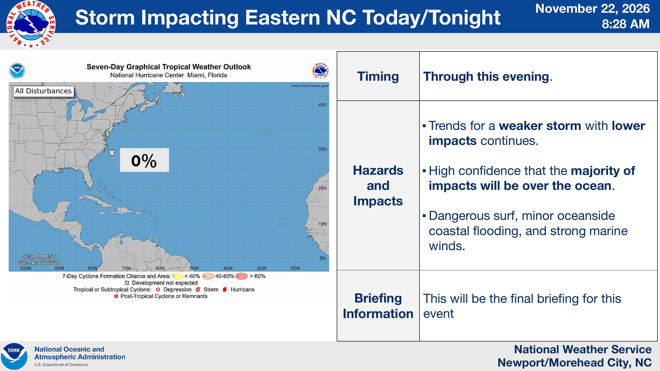
The National Weather Service says this is its final briefing for this storm event. The seven-day tropical development probability is now 0%, down from 10% in yesterday afternoon’s update. The forecast continues to trend toward a weaker storm, with most impacts expected over the ocean.
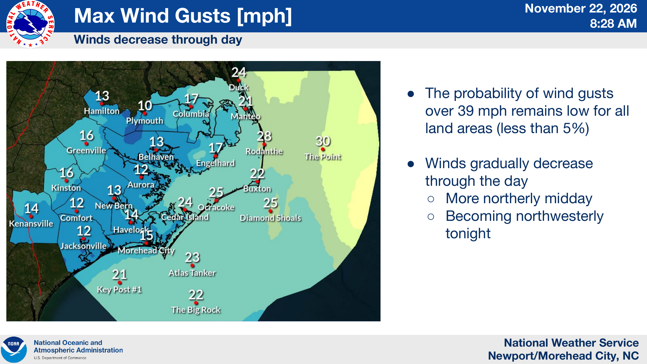
The remaining impacts are expected through this evening. Winds will gradually decrease throughout the day, and the probability of gusts over 39 mph remains below 5% across land areas. Dangerous surf, minor oceanside coastal flooding, strong marine winds and possible beach erosion remain concerns.
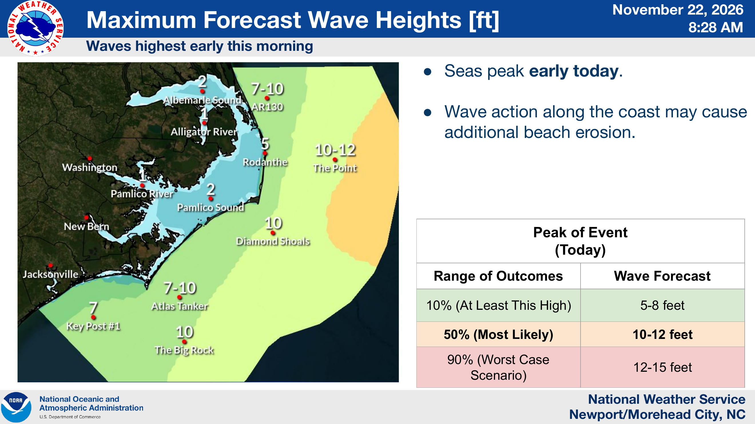
Seas were forecast to be highest early this morning. The most likely peak wave-height range is now 10–12 feet (previously 8–12 feet), while the worst-case range is 12–15 feet (previously 10–15 feet). The NWS notes that wave action along the coast could cause additional beach erosion.
Source & credit
Credit: National Weather Service Newport/Morehead City, NC.